

After a very hot/dry summer and early fall (which will be discussed in a future post), we start seeing a pattern change as we continued into the fall, especially with the coming La-Nina event. An unseasonably strong trough developed across the Central USA, with a very strong low-pressure system across the Omaha area and into the Minnesota/Wisconsin area. This combined with highs in the mid to upper 80s and a humid airmass. A very strong low-level jet contributed to very strong wind shear that led to tornadic supercells forming which then merged into a broken squall line.
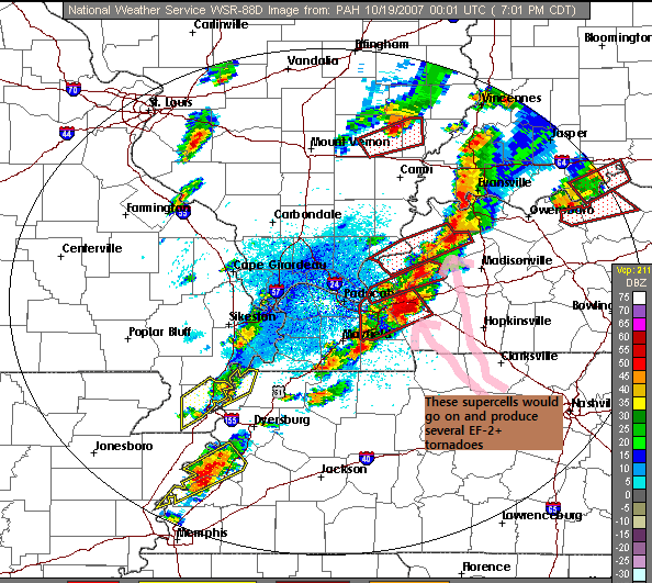
In the late afternoon, after 4-5pm scattered supercells started to form as the low-level jet starts to increase. The first supercell seen leaving Hancock County produced the first significant tornado of the day which was an EF-2 tornado just east of Owensboro into Hancock County.
The most significant event started between 7-9pm, with 6 (EF-2) tornadoes and 1 (EF-3) tornado with this broken line of supercells, seen above. The one near Dixon, KY produced a significant EF-2 tornado producing significant damage Sebree, Beech Grove, and West Louisville along with golfball sized hail, and the EF-3 tornado just north of the airport and across the riverfront area of Owensboro. With over 11 million dollars and significant damage to historic buildings and churches.
The tornadic supercell moving into Caldwell County from Lyon County, on the radar above produced a significant series of EF-2 tornadoes in the Cobb area, Pennyrile Forest area, and just south of St. Charles (S Caldwell, NW Christian, S Hopkins), before hitting Nortonville as an EF-1. Another storm quickly formed from that moderate shower in NW TN, and produced tornadoes in SE Calloway and Southern Trigg County. Storms then merged into a squall line and produced damaging winds. There were several injuries with this event, but thankfully no fatalities.
Reasons Why the Event Was Significant
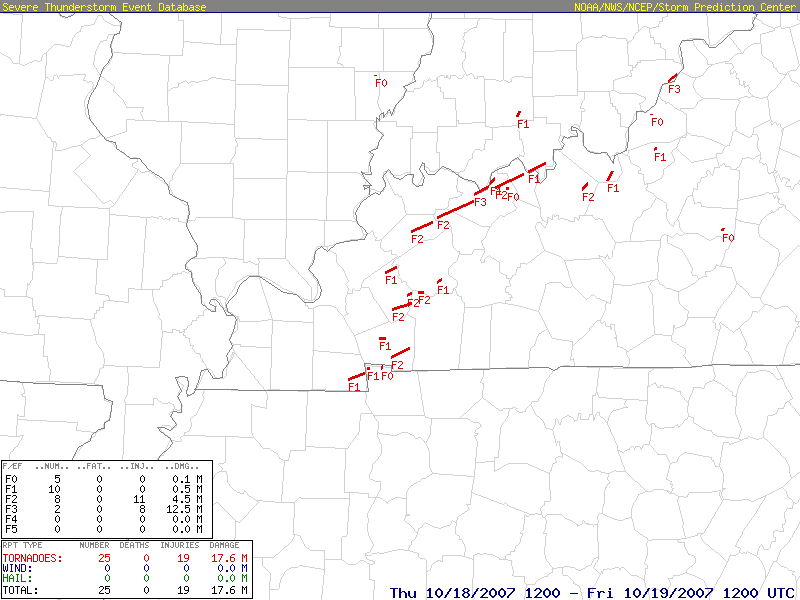
- This is the largest tornado outbreak in our area as far as the number of tornadoes, with 16 separate tornado tracks.
- Eight tornadoes were rated EF-2 to EF-3 in this event
- Several populated areas/state parks were impacted including; Owensboro, Sebree, Nortonville, and the Land Between the Lakes and Pennyrile Forest area.
Stay tuned tomorrow for events #37 and #38
