
Another day and another major fall tornado outbreak to cover. This setup was similar in many ways to the 10/18/2007 event. A strong surface low tracking from NW MO/SW IA into Wisconsin (just southeast of the 10/18 event), along with enough instability (500-1000 CAPE, which is enough in a strong fall severe weather setup) allowed for supercells to form across the area. The forcing wasn’t as strong as places up north in IN/OH, so that allowed for storms to stay supercelluar, which led to some long-tracked storms.
There were two main supercells that produced the tornadoes for this event
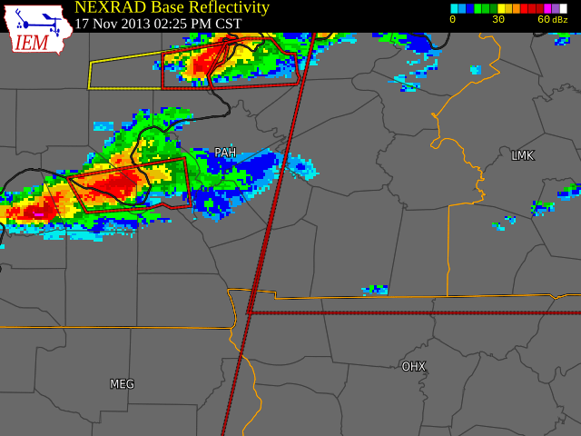
The Tornado Warned storm to the south (the red box around Paducah was responsible for the damage on the NW side of Paducah, the damage in Brookport, IL (where it became deadly) and for hitting the southside of Smithland. The damage at the Uranium plant northwest of Paducah and Smithland was EF-2. There was a small area of EF-3 damage in Brookport. This supercell will be long-tracked.
The storm to the north would eventually produce the EF-3 tornado that hit Morganfield/Waverly/Corydon areas where nearly 1 million dollars of damage occurred.
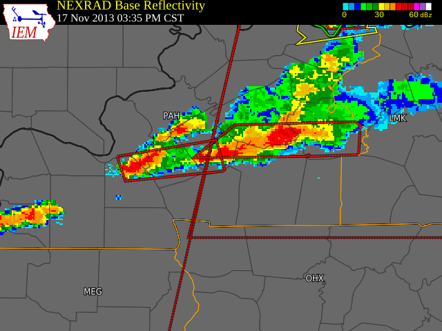
The Brookport/Smithland supercell produces an EF-1 tornado near Princeton, but produces another EF-3 tornado just south of Nortonville and White Plains producing minor injuries and destroying at least one structure by leaving just the interior walls. Two EF-1 tornadoes also occur in SE Muhlenberg County and the Huntsville area of SW Butler County with this same cell, before finally weakening just north of Bowling Green after producing tornadoes in MO/IL and across our coverage area.
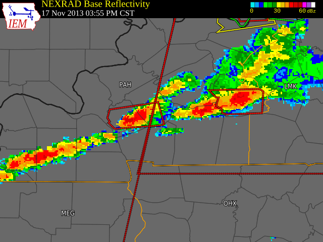
This picture shows the tornadic supercell in Muhlenberg County before moving into Butler County.
What Makes this Event Significant
- There were only 3 events, which featured three different EF-3 or greater tornado tracks across our coverage area. This event was one of those events, the other two will be covered in this blog series later on. We will cover many tornado outbreaks in this series, but this is one of the very few events where we saw multiple significant tornadoes in one event.
- Several populated areas sustained some damage to either tornadoes or damaging winds including Paducah, Morganfield, Nortonville, and Princeton
Some Links
https://www.spc.noaa.gov/exper/archive/event.php?date=20131117
NWS PAH summary of this event
