
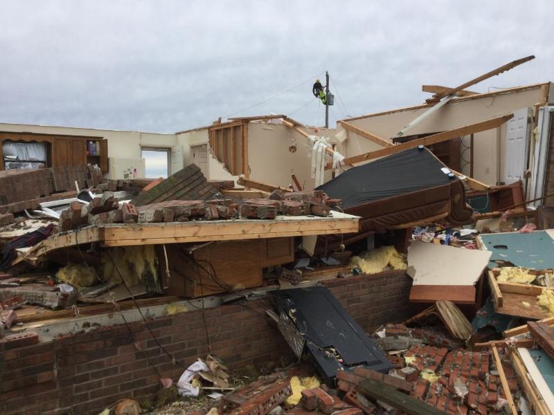
^^ High-end EF-2 Tornado Damage from southern Logan County (Dot/Keysburg area), from the NWS of Louisville ^^
February 24th, 2018 was one of the most destructive/active days of the 2010s for Western KY. Storms formed along a mod There were two rounds of severe weather that significantly impacted the area, in addition to rounds of heavy rain that added to a very wet February. Several areas received 5 to 9 inches of rain over the last 5 days leading up to 2/24/2018. Sadly two fatalities occurred (1 in Simpson and 1 in Union) due to Flash Flooding as well as some roads and structures damaged.
The first round occurred with a discrete supercell (see the IEM Radar image below) that formed in the mid-afternoon. This produced 2 tornadoes, including a deadly high-end EF-2 tornado in Southern Logan County. Significantly damaging a few homes and a family farm. Sadly 1 fatality occurred, which at the time ended a 10-year streak for our area, in which we went without a tornado fatality. Another tornado (EF-1) occurred near the Warren/Barren County line with this round.
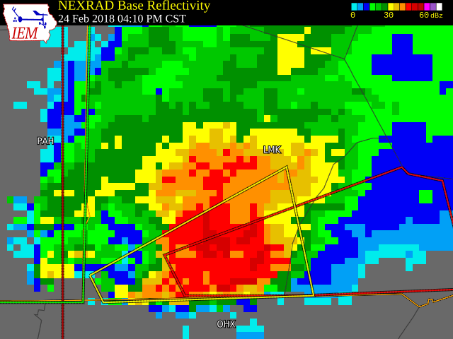
The storm that produced the deadly EF-2 tornado over the Dot/Keysburg area
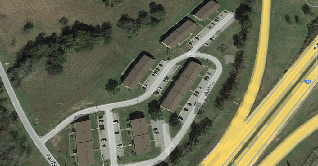
The second round was a QLCS (a line of storms with both bow echos/supercells). This produced 10 tornadoes, including those that impacted the Hopkinsville (EF-2), Lewisburg (EF-1), and Murray areas (EF-1). The one that hit the southeast side of Hopkinsville was also rated a high-end EF-2 and did $6-7 million dollars in damage and caused 9 injuries when it struck a series of apartments. Damage was also done to several businesses in town on US 41-A (Ft. Campbell Blvd). Two homes were destroyed with an EF-1 tornado that struck the southside of Murray. Damaging winds up to 70MPH also occurred with this line.


Why Was This Event Significant
- This event produced 3 fatalities. Many of our Top 32 events sadly have produced fatalities. Showing us the need to be prepared and ready for the extreme weather that we are prone to.
- We had widespread flash flooding causing over 2 million dollars in damage. This also led to river flooding which was the worst in 7 years.
- This tornado outbreak, even if it didn’t produce EF-3+ tornadoes, these tornadoes inflicted over 8 million dollars of damage and produced several injuries and a fatality. Just to show you that an EF-1 or EF-2 tornado is still capable of damaging or even occasionally destroying homes, and can be deadly.
- This is the largest winter-time tornado outbreak to ever occur in a winter month (Dec-Feb), with 12 tornado tracks. Making this one of the larger tornado outbreaks overall.
LINKS:
^^ Info on the Murray tornado ^^
https://www.weather.gov/lmk/SevereWeatherFloodingFebruary24-252018
^^ NWS Louisville summary ^^
https://www.weather.gov/pah/2018_Feb24_EventSummary
^^ NWS Paducah summary ^^
