
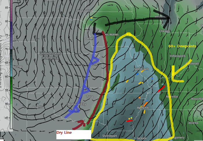
We are within our Top 20, list of significant events and this will be our final event of the 1960s for this list. Unfortunately, there is not a lot of information about this setup so we are relying on weather maps and the April 1968 Storm Data report to tell as much of the story as possible.
This setup, described above allowed for two rounds of severe thunderstorms to form overnight and into the wee-morning hours of the 4th. The first round was likely a line/cluster of storms that produced widespread wind damage in Daviess, Hancock, and Todd Counties (we cannot rule out some embedded tornadoes within that area of straight-line wind damage) but we didn’t have the technology or resources to differentiate between the two) but several homes, industrial buildings, and mobile homes were damaged or destroyed with a few injuries.
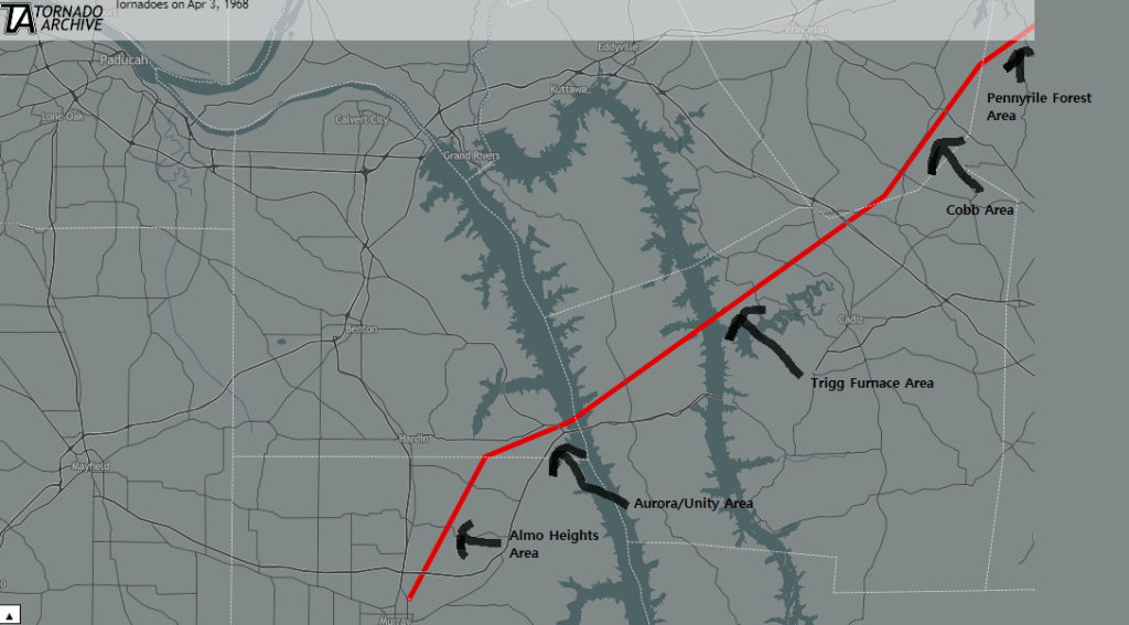
The second round was a storm (we are not sure if it was a discrete supercell or a supercelluar feature within a squall line) that moved through our area and produced a long-tracked deadly F-4 tornado. It touched down on the northern outskirts of Murray at 11:30pm (4/3) hitting a trailer park before impacting the Almo Heights area of the county. It produced 1 fatality at this location along with at least 10 injuries. It then moved into southeastern Marshall County striking the Aurora/Unity community head-on causing 1 fatality and several injuries along with completely destroyed homes. Over 50 homes in Calloway and Marshall County were heavily damaged or destroyed. The tornado became 1-mile wide as it moved across Land Between the Lakes and impacted the Trigg Furnace area, before moving into Caldwell County impacting the Cobb community and causing 5 injuries. After that it moved into NW Christian County where it did severe damage to the Pennyrile Forest lodge and several farms in the area before lifting a hour later at 12:30am (4/4). All in all tracking over 50 miles (becoming one of the longer-tracked tornadoes in our areas history) killed 2 people, injured 30, and probably caused at least ten million dollars of damage in today’s estimates. This storm would then produce widespread wind damage across Christian, Hopkins, and Todd Counties. Again, we can’t rule out there were some additional embedded short-track tornadoes within that wind damage.
Major flash flooding also occurred across our southeastern counties due to repeated heavy rains. Russellville reported 6 inches of rain with this event, leading to evacuation of hundreds of homes and roads flooded across the area. With the worst flooding occurring along US 79 from Guthrie to Russellville. According to 1968 storm data, water was up to 8 feet high in some homes in Guthrie.
Why Was This Significant
- The combination of track length (50+ miles), fatalities, and F/EF-4 intensity make this tornado easily one of the most significant to ever occur in our area during the 1950-1999 timeframe. For Marshall County, this is the 2nd (EF/F-4 tornado) to occur in that county in 4 years (see event #20 in this countdown).
Trivia
- For those into US History and especially the Civil Rights movement, the assassination of Dr. Martin Luther King Jr. would occur about 6 hours after our tornado dissipated over Northern Christian County. This happened in Memphis, TN in which just 9 hours before the assassination there was a deadly EF/F-3 tornado that formed in the northern part of Memphis metro before moving north and hitting Covington, TN.
Storm Data 1964 Link (Scroll to Page 6 for Kentucky)
https://www.ncei.noaa.gov/pub/orders/IPS/IPS-863027E5-0DF6-4512-83C5-63D6FA1C9DD2.pdf
