
On April 16th, 1998 a significant low-pressure system is moving across the Great Lakes, with a strong low-level jet through Middle TN into Kentucky. A High Risk was in effect in the KY/TN border down into Middle TN. A broad-based trough allowed for subtle to moderate around of forcing, enough to form discrete supercells across the area. A very warm and humid airmass was in place as well allowing for storms to quickly become severe. In our area, our significant supercell was from one singular supercell that formed in the Southern Jackson Purchase and then quickly became severe into Christian County. The storm produced a downburst of over 90-100MPH winds on the northside of Hopkinsville causing 2 injuries due to damage to a mobile home. This storm moved into Todd County and produced golfball sized hail in the northern part of the county.
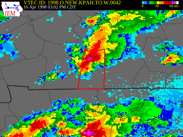
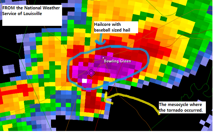
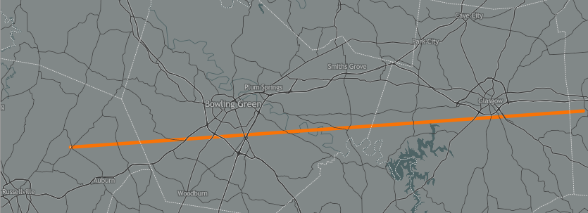
The storm then moved into Logan County, north of Russellville where it then produced up to baseball sized hail starting in NE Logan County and into Bowling Green. Just to the south of the hailstorm a tornado forms near Chandler’s Chapel. The hailstorm moved right over Bowling Green, producing baseball-sized hail (some reports of Softball-sized hail also occurred). The hailcore was very large and moved across pretty much the entirety of Bowling Green. Over 8,000 homes were damaged, thousands of automobiles were totaled across the area (including every single vehicle at every single car lot and at Greenwood Mall), and apartment buildings. This storm caused a half-billion dollars in 1998 dollars, which would be north of 900 million today. At this time a tornado from NE Logan County into Warren County, passing just south of Bowling Green and Greenwood Mall. The damage was EF/F-1, but the tornado did reach F-3 strength as it left Warren County into Barren County. The hail accumulation but heavy rain led to widespread street flooding in Bowling Green.
Why Was This Event Significant
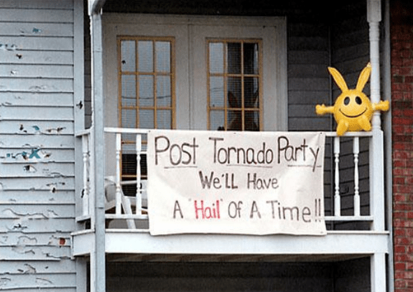
- April 16th, 1998 was the most expensive day in Western Kentucky history (outside of 12/10 and 12/11/2021). The hailstorm is still talked about in Bowling Green history to this very day.
Links (Some really good links)
https://www.wbko.com/content/news/20-years-later-a-look-at-the-1998-hail-storm-479931053.html
^^ WBKO report^^
https://kyclimate.org/topic/6405301122597937088
^^ A great reading by the Kentucky Climate Center
