
What happens when you have the remnants of what was once a powerful hurricane, it merges with a moderately strong cold front, and you have steep lapse rates (drier air aloft to bring winds down)? You can get a high-wind event that makes you feel like you are in a hurricane or at least a significant tropical storm. That is what happened during the morning and afternoon hours of September 14th, 2008. The rapid speed of this low-pressure system also contributed to this high wind event.
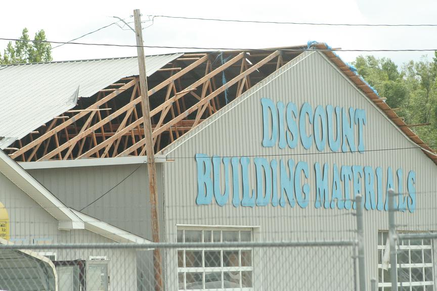
Between 8am through Noon we had consistent 55-60+MPH wind gusts. Calvert City and Owensboro both reported near 75MPH wind gusts. Grand Rivers reported a wind gust of 78MPH. Everyone in the Jackson Purchase, Fluorspar District, and Western KY Coalfields experienced a period of 60-65+MPH wind gusts. With everyone down to the TN border experiencing at least 45MPH gusts at times. Carlisle County reported at 62+MPH sustained wind for 15 minutes straight. 20 homes were destroyed in Carlisle County due to these winds, the Governor declared a State of Emergency, and a shelter was opened up for people who lost their homes or were without power which was pretty much the entire county. 2/3rds of the residents in our area lost power during this event, which was the worst power outage in our history (outside of January 2009). Ballard, Fulton, and Graves saw over 100 structures with damage. Crittenden and Daviess County estimate that at least 1,000 homes in each county saw some sort of damage. Dozens of roads were blocked in every single county. Thankfully there were not any fatalities but 39 injuries and over $170 million dollars of damage was inflicted upon the area in both property and crop damage (likely over $300 million in 2024 dollars). Power was out for almost a week and at the time this event involved some of the worst/most widespread power outage issues ever observed in our area.
Why Was This Event Significant
This event was quite significant for two main reasons.
- The widespread nature of the damaging winds. This along with the 2009 Ice Storm (which makes our Top 10 which shouldn’t be a spoiler to anyone) featured the worst widespread damage of any modern weather event. Every county was affected and the counties that were hit the hardest had major disruptions to their daily life, which is the definition of a significant weather event.
- This was a very unique event in which you had the remains of a powerful tropical system deliver these widespread effects well-inland. The right conditions had to be met perfectly in order for this event to take off. We had some high and damaging winds from previous storms like Katrina (2005) or Olga (2019) on a smaller scale, but you didn’t have the combination of rapid low-pressure movement, rushing dry air, and steep lapse rates, and the merge with a strong frontal boundary to produce these damaging winds on a region-wide level.
Links:
https://www.weather.gov/pah/IkeRemnantsSept14_2008
^^ NWS of Paducah summary ^^
