
We begin the Top-10 most significant events (we are truly now discussing the worst of the worst) with a series of tornado outbreaks in early to mid-November of 2005, along with one of the worst flash floods for Morganfield and Henderson.
November 6th Event:
The first event was a classic overnight significant tornado outbreak for our area. The setup wasn’t extremely impressive, but it did feature a localized corridor of increased instability and a cold front with just enough wind shear available along with a semi-discrete supercell mode. Overnight the low-level jet ramped up producing even more enhanced wind-shear.
The Storms:
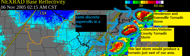
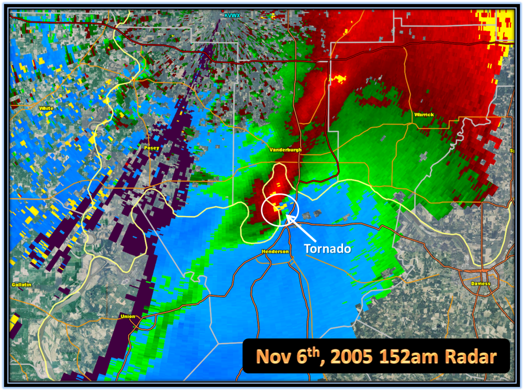
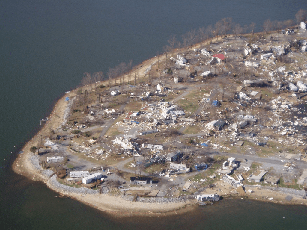
We had a broken line of storms (the picture above) from IEM. There were three major storms within this broken line of semi-discrete supercells. The two up north were the main supercells in our area with the one further south not producing a tornado into Hart County (just east of our coverage area). The first tornado was an EF-3 that touched down in Smith Mills in NW Henderson County before moving into Ellis Park in Henderson. There it did significant damage across Ellis Park causing millions of dollars and some injuries. Sadly this tornado would strike a mobile home park in SE Evansville producing a mass causality situation in a mobile home park killing 24 people.
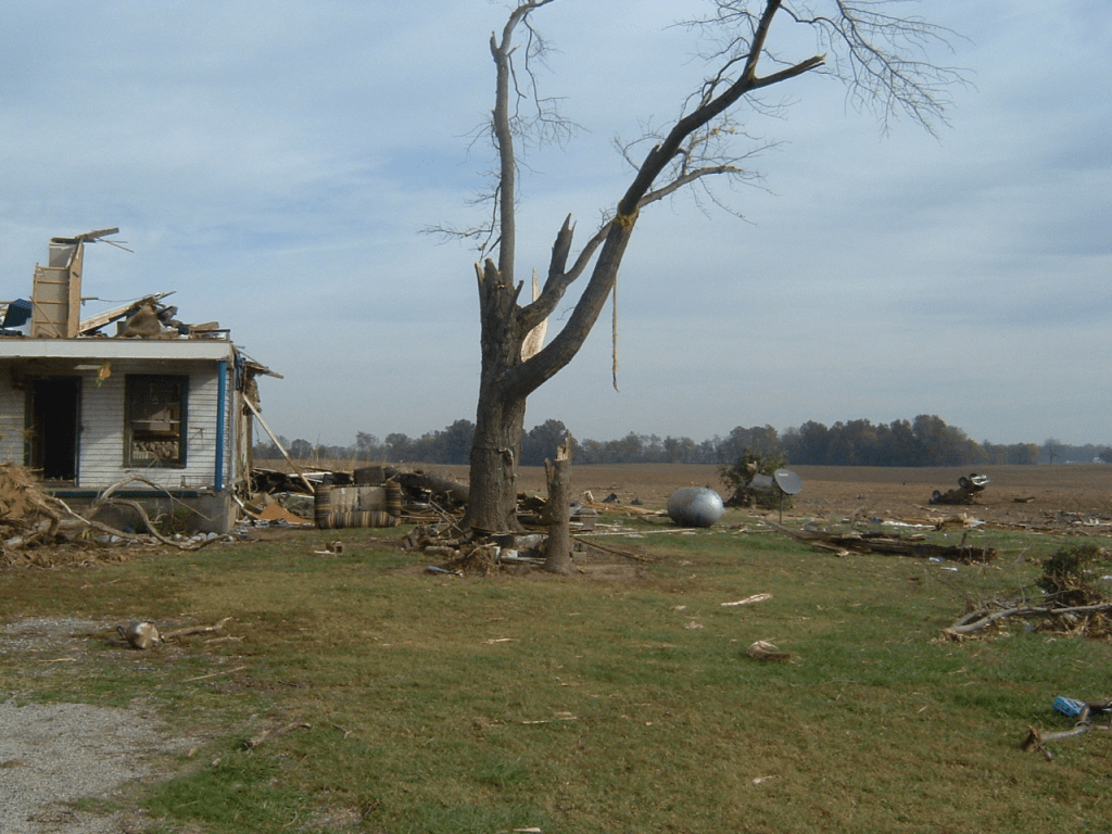
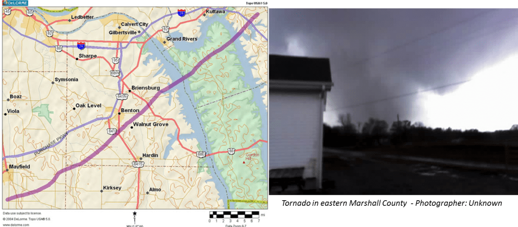
The second storm produced a significant EF-3 tornado in Crittenden County into Webster County. This tornado caused 5 injuries, destroyed several structures, and carried a boat over 400 yards according to Storm Data in Crittenden County along KY-365, north of Mattoon. This tornado weakened slightly but still did damage before lifting near the community of Wheatcroft in Webster County.

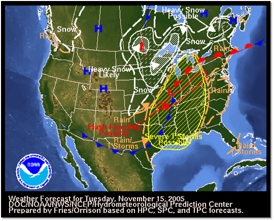
November 14-15th, 2005 Flash Flooding
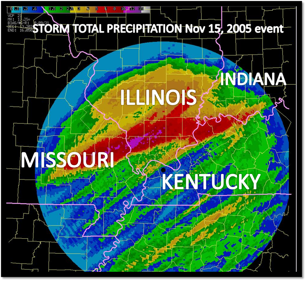
A widespread 6-10 inches of rain fell across Union and Henderson County overnight as a stalled out warm-frontal boundary was located in that area and thunderstorms kept regenerating along that boundary. This led to over 18 million dollars (probably over $30 million in 2024 dollars) of damage to Union and especially Henderson County, particularly the city of Henderson. In Union County a shopping center, auto stores, and the local YMCA were flooded. In Henderson. several neighborhoods were completely flooded and the Canoe Creek flooded the industrial park with several feet of water.
November 15th Tornado Outbreak:
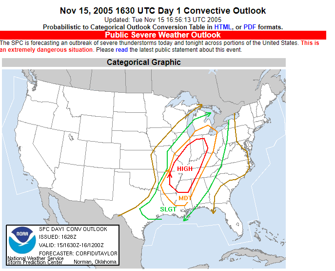
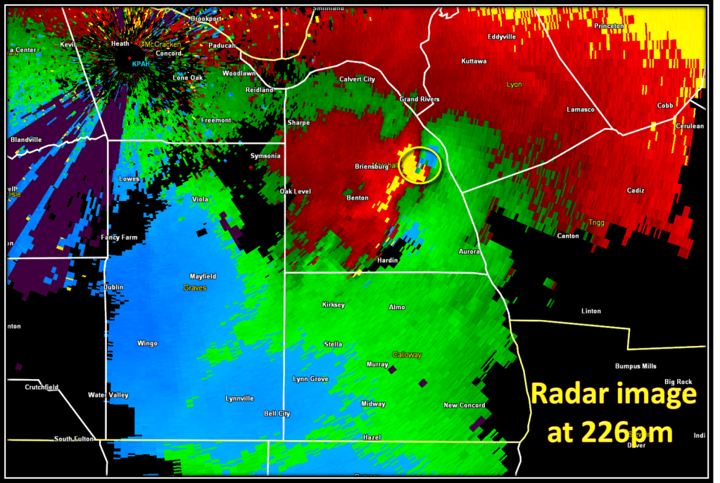
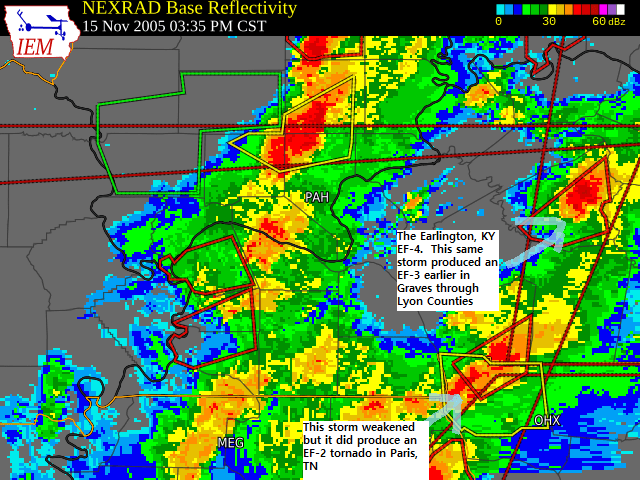
Almost all of our severe weather on 11/15/2005 occurred from one long-tracked supercell that tracked across the entire area. There were two major tornadoes (an EF-3 and the only EF-4 in the US in 2005). There were also two brief tornadoes one was in Calhoun in McLean County and one was an EF-0 near Utica, KY (southern Daviess County).
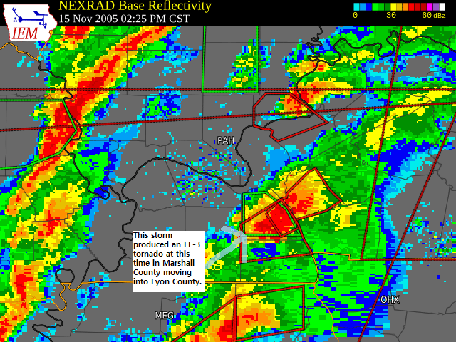
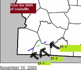
This tornado began just south of Mayfield. The tornado did mostly EF-1 tornado in Graves and the far NW Calloway County. Marshall County was the hardest hit especially from the southeast side of Benton to the Moor’s Resort area. This area had EF-3 tornado damage with over 150 structures destroyed (mostly in Marshall County). Lyon County experienced EF-2 tornado damage which mostly knocked trees down. Sadly this tornado caused 1 fatality in Marshall County.
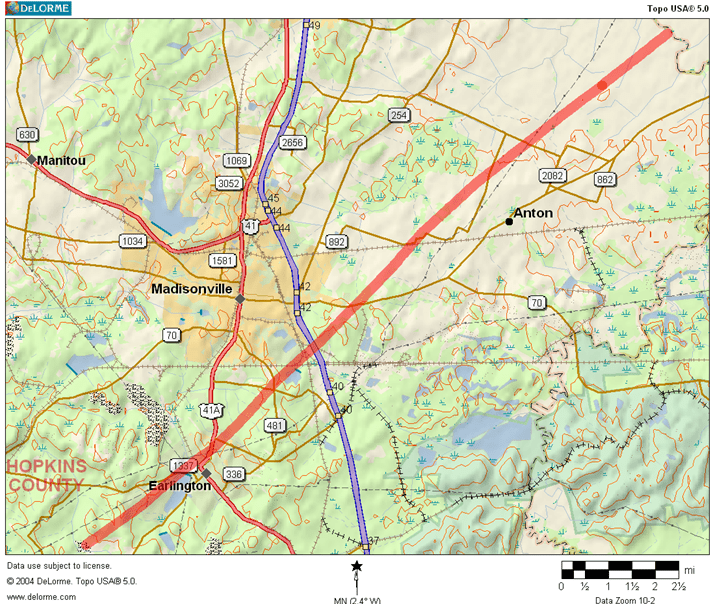
The supercell recycled over Caldwell and southwestern Hopkins County. This tornado touched down just southwest of Earlington before moving into Earlington and the northside (just north of the Dec 2021 and May 2024 tracks). This tornado then moved into the southeast part of Madisonville. Altogether we had 22 injuries and over 50 million dollars of damage in 2024 dollar amounts. Nearly 250 structures were destroyed or heavily damaged.
Another supercell tracked out of Tennessee and produced 3 tornadoes from north of Adairville (taking a track similar to the 3/4/1964 tornado), a lower-end EF-2 in NW Simpson County, and an EF-1 in Woodburn (SW Warren County). This is mostly rural so most of the damage was to barns and such.
Why Was This Significant
Between the November 6th and November 15th events we had over 10 tornadoes with four of them ranking EF-3/F-3 or higher. It isn’t common to have multiple EF-3+ tornadoes in one outbreak at all in any part of the country, but to have this occur twice in one month is very noteworthy. We had 1 fatality, over 50 injuries, and over $100 million dollars in property damage as the result of the flooding and severe weather during this 9-day period.
Links
https://www.weather.gov/pah/Nov152005TornadoOutbreak
^^ NWS Paducah ^^
https://www.cbsnews.com/pictures/midwest-storms-16-11-05/7/
^^ CBS article ^^
https://www.wave3.com/story/4124732/one-death-injuries-reported-from-storms-in-western-kentucky/
^^ Wave 3 article^^
