
Our first major weather event occurred five days into the new year. This event for some areas, was the worst winter storm since 2016, and was the most impactful winter storm for the state of Kentucky since the January Blizzard of 2016.
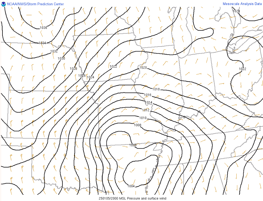
A surface low is moving across Arkansas and Tennessee, just to our south, as surface temperatures were at or just below freezing. From the SPC and NWS of Louisville
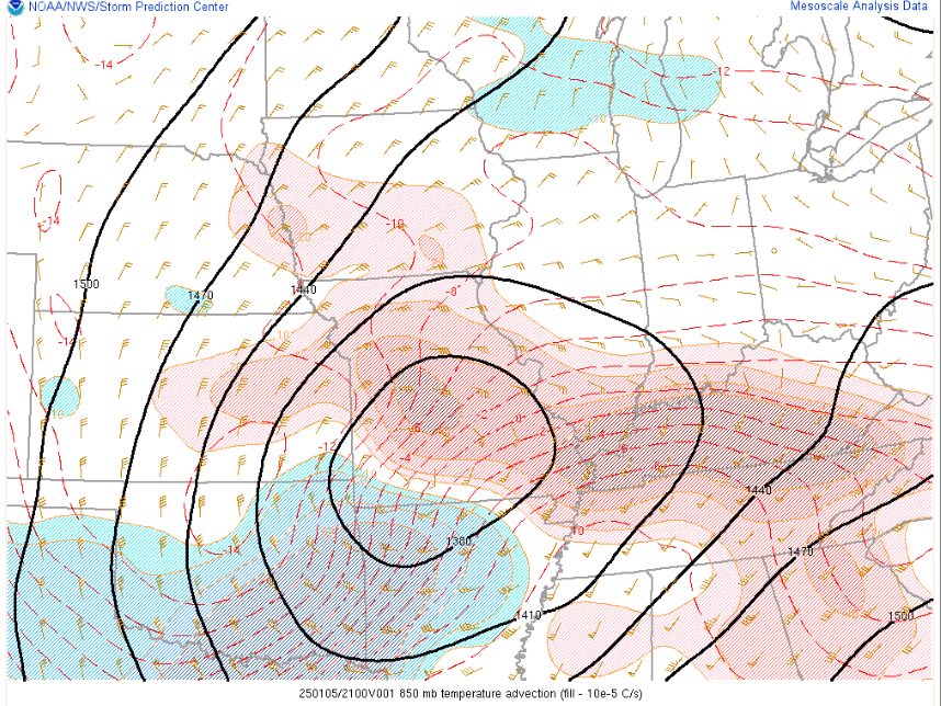
While that was going on, a few thousand feet just above the surface, an area of warm air (called warm-air advection moved through. While temperatures were at or just below freezing, the air just above us was above freezing. Allowing for rain to fall throughout the atmosphere until it froze on contact near the surface, creating extensive sleet and freezing rain. From the SPC and NWS of Louisville
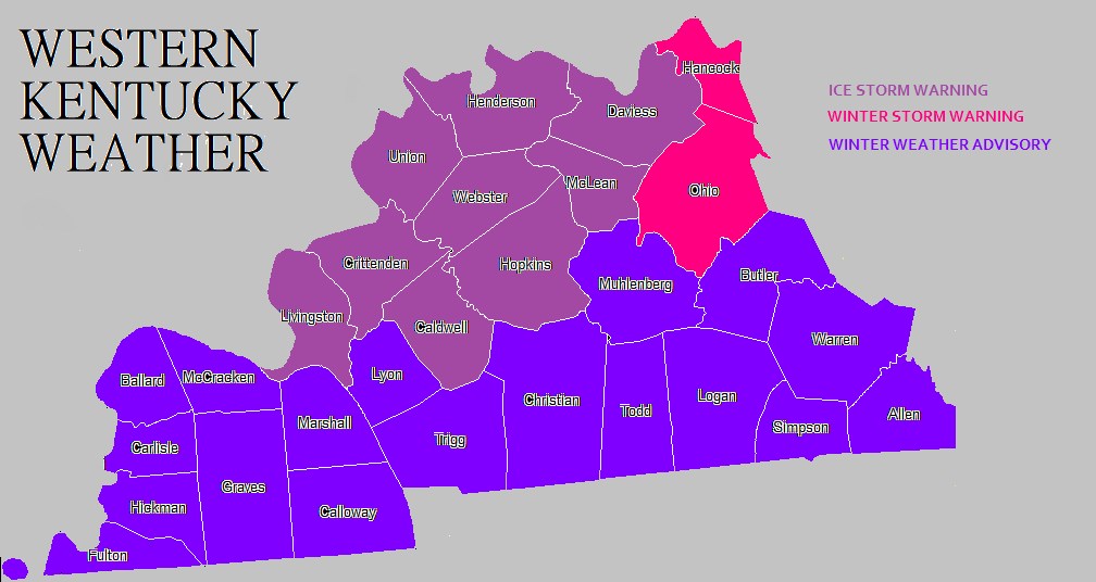
Models did a pretty good job picking out this storm, although it was a tough forecast because we were on the southern edge of this event. A significant ice storm was expected closer to the Ohio River, with more nuisance ice accumulations before changing to rain closer to the TN border.
RESULTS

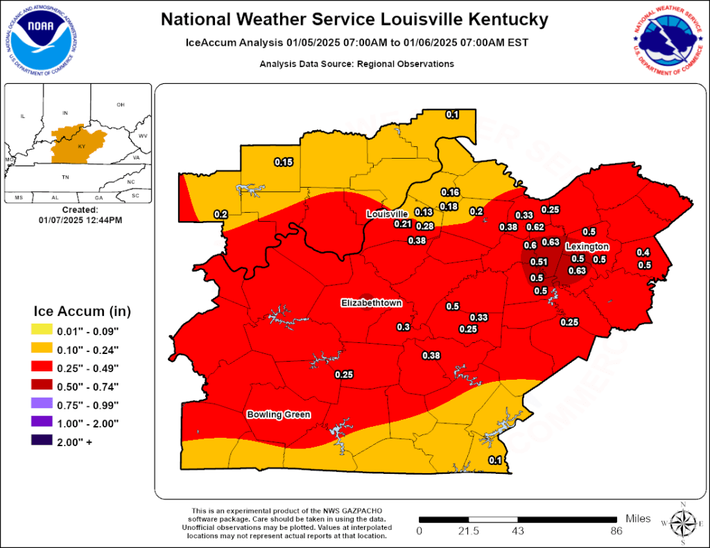
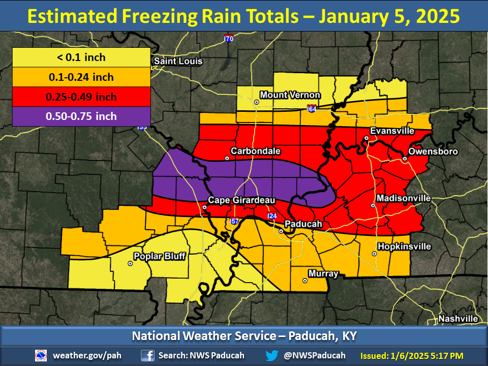

The storm produced up to 3/4th of a inch of ice across parts of Livingston, Crittenden, and Union Counties, creating power outages that lasted for several days. Just to the north in Henderson/Owensboro we had 1-4 inches of snow/sleet. Road conditions across the area, especially along and north of US 62 were hazardous for several days. Damage was around $2 million, with significant impacts that lasted for days.
