
SETUP:
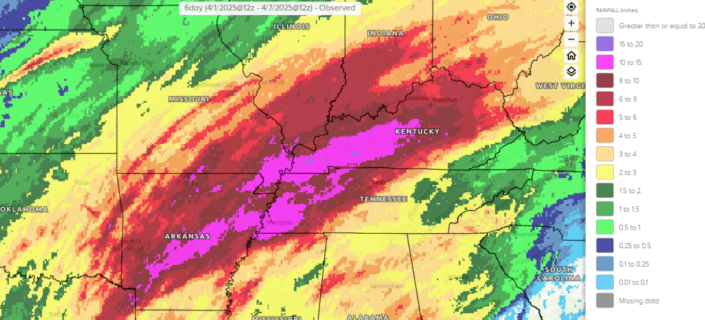
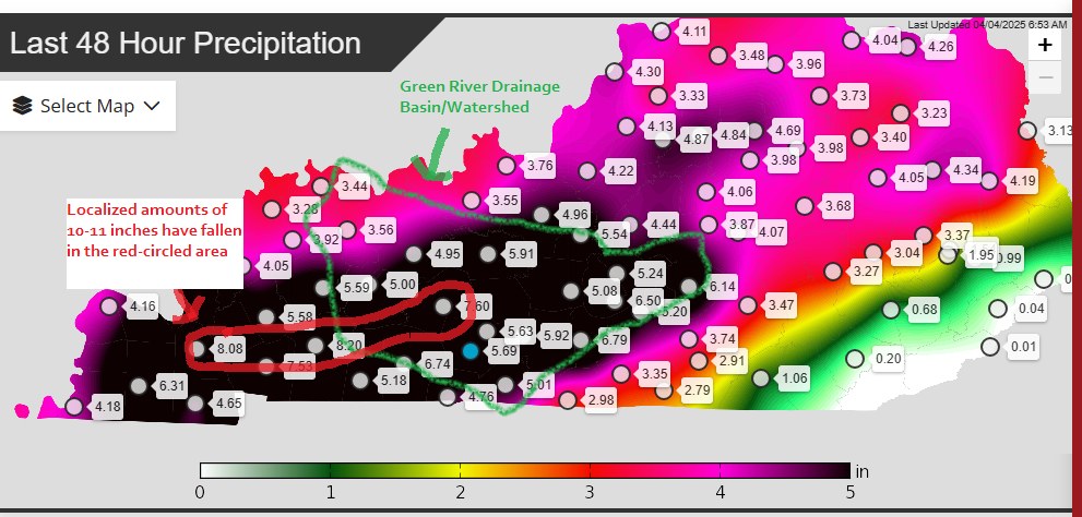
The setup was as described in the severe weather post. We had a long/broad, and slow-moving trough, which generated multiple systems and multiple rounds of heavy rain. In addition, we had record warm Gulf waters, which led to record moisture content and humidity. This allowed for storms to produce 1 to 2 per hour, plus rainfall rates. The worst flash flooding occurred on the night of April 3rd into April 4th, where training rainfall produced 5-10 inches of rain from Graves/Marshall Counties over into Hopkins/Christian County and into Butler/Northern Warren County (where locally higher amounts occurred). This fell right over the Mud, Pond, and Tradewater River basins, leading to record rises along these smaller rivers and intense flash flooding.
Rainfall from 2nd to 4th
Additional rainfall (a widespread 2-6 inches) fell during the next 48 hours, which lead to the localized totals of 12-16 inches.
ADDITIONAL SEVERE WEATHER:
There was some isolated severe weather reports on the night of the 3rd and the afternoon of the 4th. The most notable being baseball-sized hail in SE Calloway County on the afternoon of 4th. The lion’s share of the severe weather occurred on the 2nd.
RIVER FLOODING:
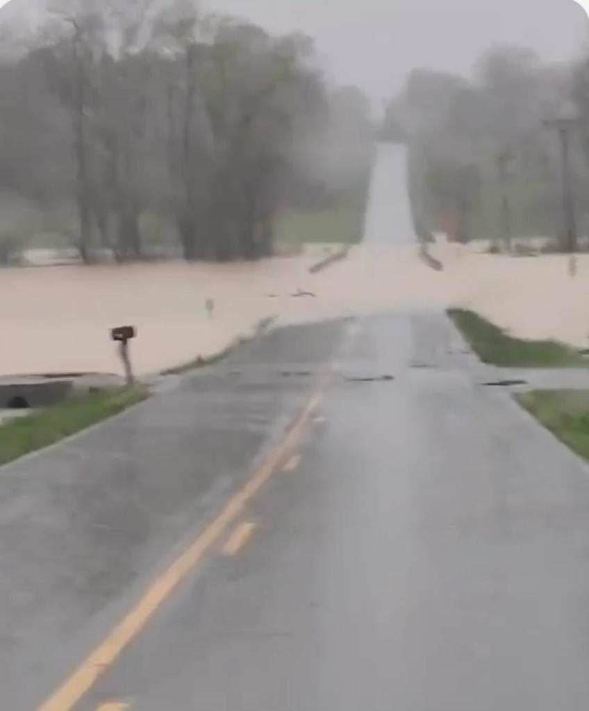
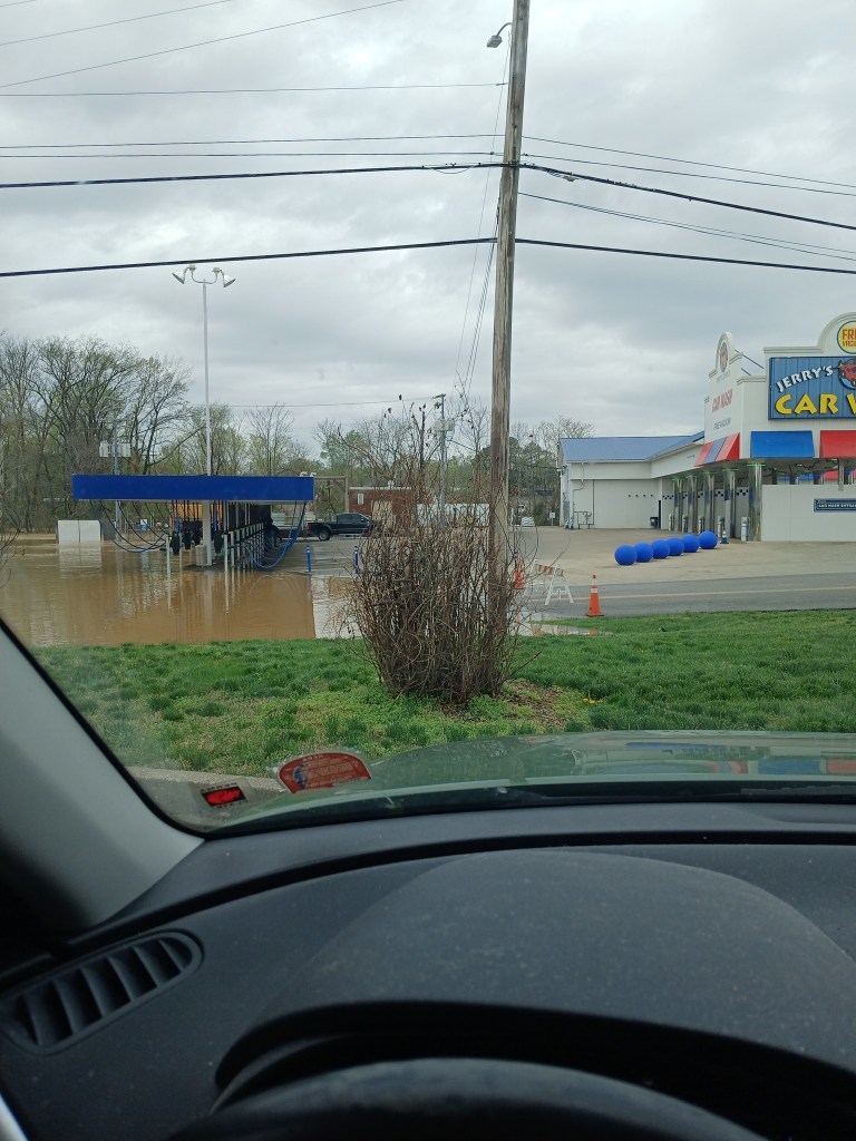
Some of the most devastating impacts from this event came from the river flooding. 6+ inches of rain fell over much of the state of Kentucky and across large parts of the entire Ohio River Valley. This led to a situation that was prime for river flooding. In addition, the heaviest rainfall on the night of the 3rd into the 4th fell right over the Mud, Pond, and Tradewater River basins across Hopkins, North Christian, Muhlenberg, Butler, Northern Todd/Logan, and Northern Warren counties. This led to a massive amount of water that poured into the Green River.
The Green River crested above 2011 levels along the entire stretch, with river levels at or even a few feet above 1997 levels. This caused over tens of millions of dollars in damage, especially in Butler and McLean County, the latter of which had nearly half of its land surface underwater. The entire communities of Rumsey (McLean County) and Jewel City/Ashbyburg (McLean/Hopkins on KY-138) are underwater.
The Tradewater River at Dawson Springs crests above the 1937 level, leading to much of the city of Dawson Springs to go underwater, leading to the 2nd major disaster for the city in just 4 years.
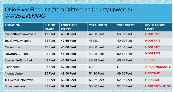

Impacts: The Ohio River would crest under 2011 levels in most places, but still caused damage to bottomland areas and flood prone areas. The Tradewater, Clarks, Green, and Rough Rivers were all near or at historic levels. This was a 1 in 100 year event in many areas.
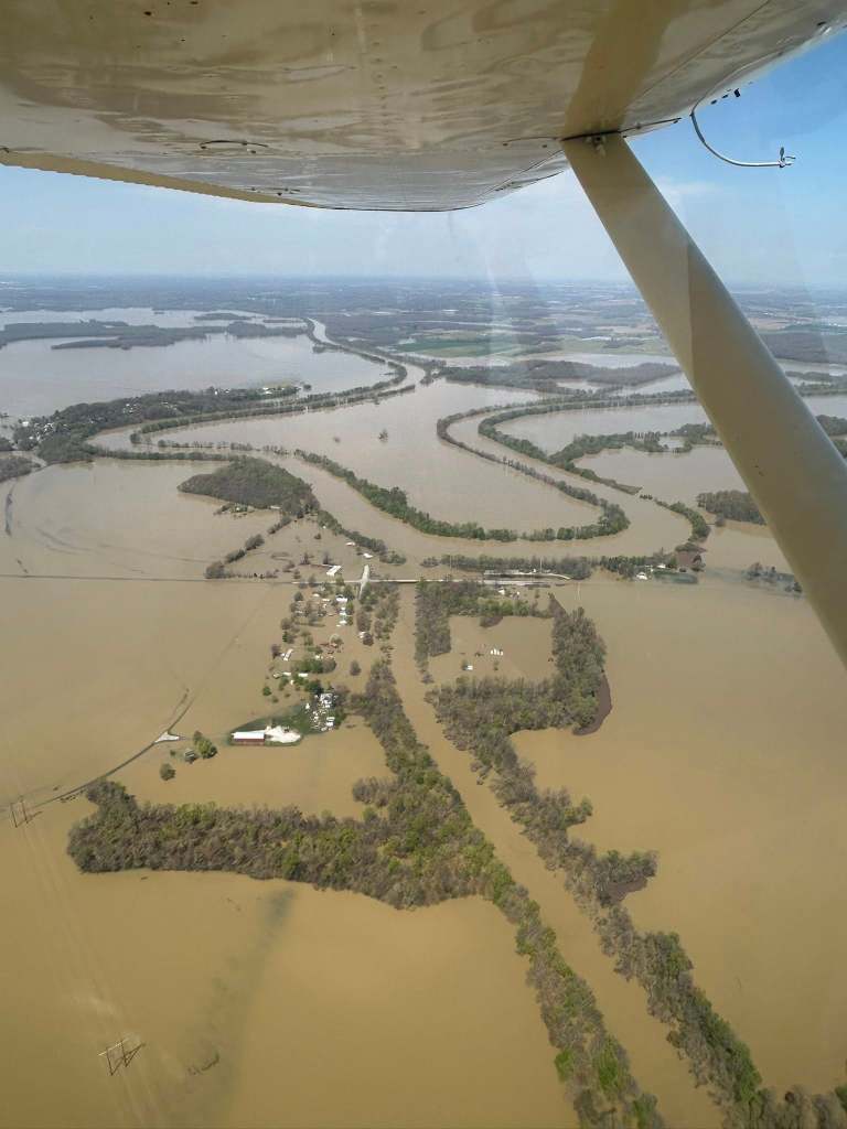
Photo of Jewel City by Austin Revlett


