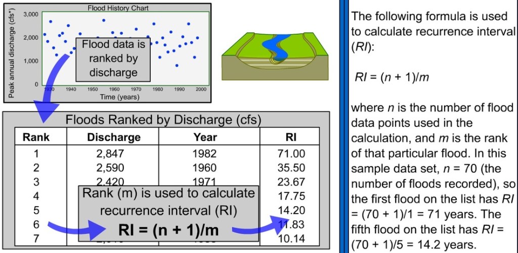
Our concept of the day that we are going to talk about today is Recurrence Rate or Recurrence Intervals. A concept that is not well-understood by many.
Especially with flooding in Texas and North Carolina making headlines, and our area recovering from the February and April floods of this year, you are hearing about a “1 in 500 year event” and so on.
A recurrence rate or interval is the probability of a certain event occurring in an area.
The heavy rainfall that caused major flooding in April was considered to be a 1 in 100 year event. This means that each year has a 1% chance of experiencing a flood/heavy rain event that equals or exceeds what we experienced this past April.
This does not mean that an event like this past April will only occur every 100 years. In a matter of fact, the probability of the event occurring gradually increases the more time that goes by without said event occurring.
Also, warmer ocean and temperatures (which can hold more moisture for heavier rainfall events), changes in land use (adding more concrete or surfaces that are impermeable and don’t absorb water well), or changes in a river system due to damming, erosion control, or flood control structures can also change the recurrence rates of these events. Where a 1 in 100 event could become a 1 in 75 or 1 in 50-year event.

