
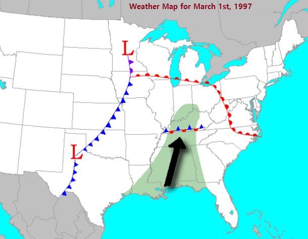
At event #12 is the final event on our all-time Top-40 weather event list from the 1990s. At the end of February into the 1st day of March, a very heavy rain event begun and it kept raining through the morning of the 2nd. A stalled-out boundary along US Highway 68 led to rounds of heavy rain with 1-2 inch per hour rainfall rates. The atmosphere was extremely saturated at about twice the normal levels for March.
Flash Flooding/Severe Weather on the 1st:
During the overnight of the 28th of Feb into March 1st a round of thunderstorms moved through producing a widespread 4-6 inches of rain. In addition, some of the storms became severe including one storm that produced a brief EF-0 tornado in Warren County and a damaging wind gust that flipped over a mobile home in Graves County and injured the person living there. Widespread road closures occurred with this overnight through midday on the 1st.
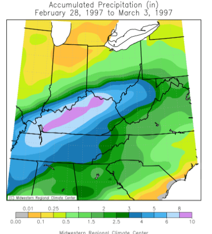
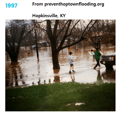
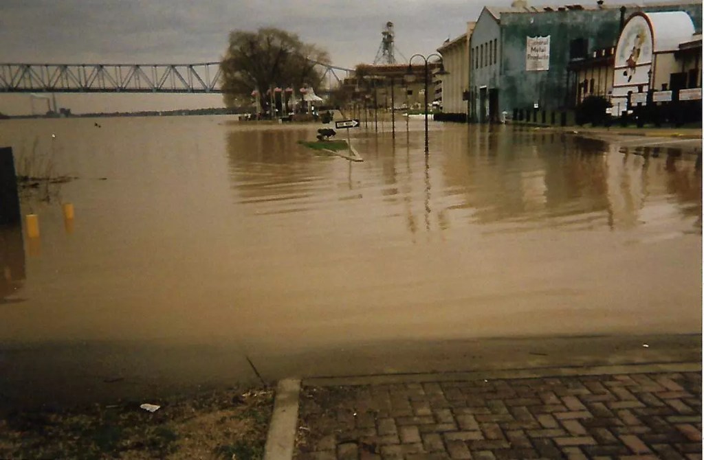
A second round of heavy rain and severe weather moved through in the later afternoon through the morning of the 2nd. Altogether we saw widespread 6 to 12 inches of rain over saturated ground. Major flash flooding occurred areawide. Union County saw flooding of the main shopping center in Morganfield which trapped employees inside the shopping center as up to 6 feet of water moved in. Hopkinsville saw tens of millions of dollars of damage as the downtown area and all surrounding low-lying areas flooded with around 600 structures impacted and travel shut down countywide. Elkton was on an island as all roads flooded in and out of town. Sadly two deaths occurred with one each in Muhlenberg and Warren Counties. Flooding impacted the medical facility in Murray as water was beginning to enter into the medical labs. Every county experienced flooding of roads and low-lying areas with all major routes in our area having sections of them flooded. A brief EF-0 tornado also touched down in Livermore and scattered damaging winds occurred as well.
The River Flooding
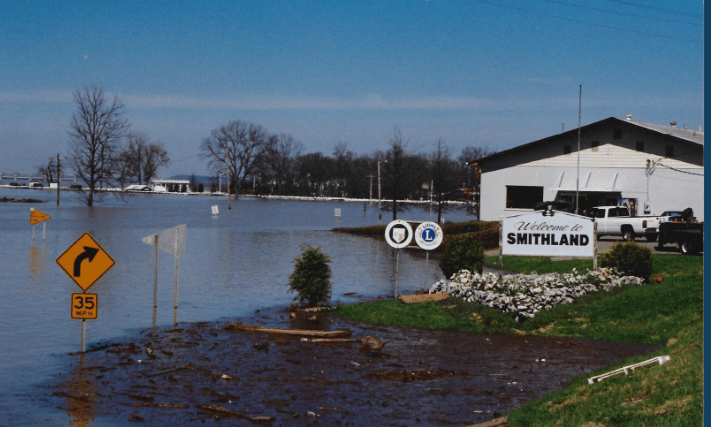
An additional 1-3 inches of rain fell on March 4-5th in addition to the Feb 28th-March 2nd major flash flooding. Since, the evaporation rate for Early March is not as high as April/May or the summer months due to lower sun angle that also led to the major flooding that occurred. Very heavy rain (6 to 12 inches) also fell across Northern Kentucky into Ohio as well so all of that excess moisture was able to run down into the lower Ohio and Green Rivers. The Green River and upper Ohio River flooding (Henderson/Owensboro area) was worse than the 2011 flood and was the worst since 1937. This led to tens of millions of damage across Daviess, Hancock, Henderson, McLean, and Webster Counties from both the Green and Ohio Rivers and smaller streams such as Panther Creek. The lower part of Calhoun and all of Rumsey in McLean County went underwater. The Beals area of eastern Henderson County was completely submerged by both effects of the Ohio and Green River. Hundreds of roads flooded in Daviess and Henderson Counties. Just like in 2011, a major sandbagging operation was needed to save the town and a hotel in Paducah had to close for the first time since 1997.
Why Was This Significant
This was the most significant weather event of the 1990s. It is one of three events that caused over $100 million dollars this decade, but this one was also deadly with 2 fatalities across our area and 17 across the state of Kentucky. Thousands of homes were flooded in this event and every county experienced road closures and disruptions to travel. Schools were closed up to 2 weeks in several areas, especially along the Ohio and Green Rivers. For the Green River and Ohio River in the Henderson/Owensboro area this is the worst flood as far as impact/damage in modern (post-1937) times.
This event was also the first major flood event that the National Weather Service of Paducah worked in their modern 58-county area. As a result of this flood, there was much improved and more modern communication between the Ohio River Center, the US Geological Survey, and the National Weather Service.
Links:
^^ An article about the flooding the Henderson area ^^
https://wbkr.com/the-six-worst-floods-in-owensboro-history-photos/
^^ WBKR the six-worst floods ^^
