When it rains it pours is what they say and in the Spring of 2011, that statement was as true as it gets. That spring was the wettest spring on record, April one of the wettest months on record, and rounds and rounds of heavy rain and severe weather would set us up for a major flooding situation at the end of April into May.
First let’s take a look at what led to the heavy rains over our area, which is the same pattern that also led to record-breaking tornado production across the Central and Eastern USA during April-May of 2011.

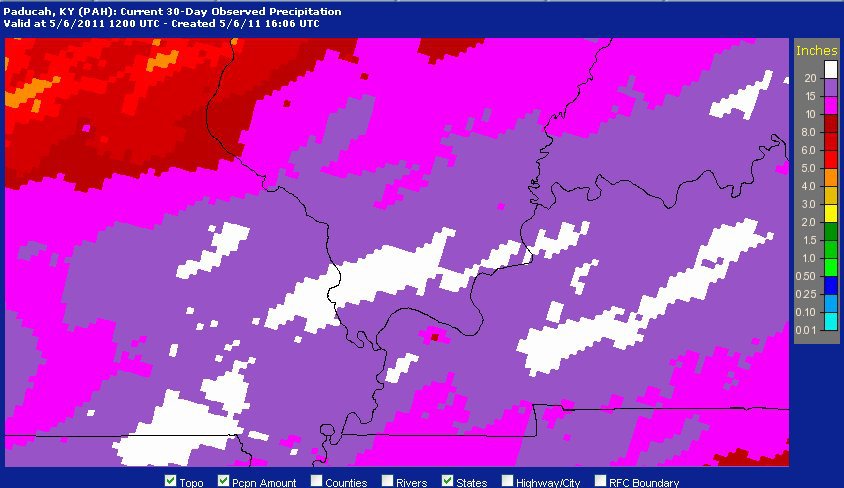
We had significant storms on the 4th of April, which produced widespread wind damage and several EF-1/EF-2 tornadoes across our area. The 15th of April produced large hail (up to golfball-sized) and a brief tornado. The 19th of April produced more widespread damaging winds and brief tornado spinups, and a whole series from the 22nd through the 27th of the month. Most of our area would see between 10-12 inches of rain just in that 22nd through 27th timeframe. We also saw around a dozen tornadoes during that timeframe with the most significant being an EF-2 that hit the Poole community on the Webster/Henderson County line on the 22nd, an EF-2 that struck Bardwell head-on during the afternoon of the 23rd, and a brief EF-3 that struck Ft. Campbell airport doing over 1 million dollars in damage during the wee-morning hours of 26th (that same line produced 100MPH damaging winds in Murray). During this time flash flooding developed in several areas leading to many road closures, but the worst of the flooding would be the river flooding that comes later.
The Rivers Rise
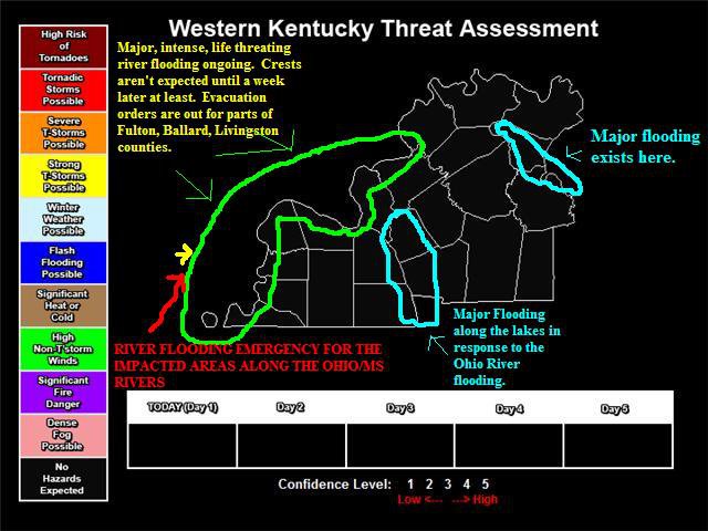
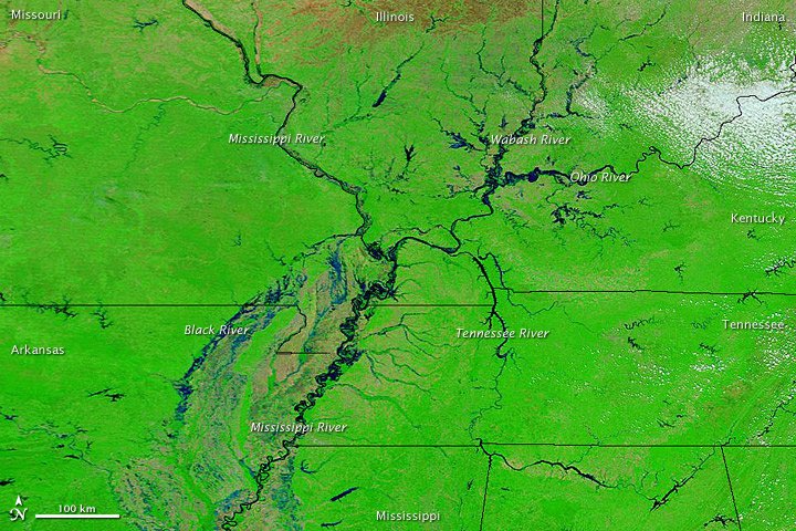
That rainfall plus snowmelt from above (Upper Midwest/Upper Rocky Mountain region) flowed into the our area, because our entire area is part of the Mississsppi River Drainage basin. This led to rises along the rivers. The Mississippi River at New Madrid and the Ohio/Mississippi intersection at Cario, IL set all-time record river levels at both locations, exceeding both the 1927 and 1937 floods. The Ohio River at Smithland exceeded their 1997 record and Paducah crested just below the 1937 level. The Green River and further upstream along the Ohio River in the Uniontown/Henderson/Owensboro area saw river crests that were just below 1997 levels, but above 1964 levels. These peaks occurred in the first-half of May and it took weeks for the rivers to fall below flood stage. Over 30-40 million dollars of property damage occurred across our counties that line the Green, Mississippi, and Ohio Rivers. Including water going into homes in Livingston County, areas outside of the floodwall in Paducah, in far-western KY, and in McLean, Daviess, Henderson, and Webster County from the combination of the Green River and backwater flooding. The activation of the Birds-Point/New Madrid area floodway did help in preventing even higher crests, and worse flooding such as the makeshift levee in Smithland or the floodwall in Paducah from being overtopped.
WHY WAS THIS EVENT SIGNIFICANT
- This event set river crest records at some points of the lower Ohio River and along the Mississippi River. If it weren’t for flood control measures that were established during the 1927, 1937, 1964, and 1997 flood events, plus excellent forecasts and outlooks by the National Weather Service and United States Geologic Survey the damage from this event would be much worse (at least several hundred million) and there could several fatalities across our area.
- The storm activity in April 2011, will be talked about for generations on end. Both the flooding impacts and the severe weather impacts, especially in some of our surrounding areas that were really hit hard by destructive/violent tornadoes.
LINKS
https://www.dispatch.com/story/news/2011/05/08/kentucky-town-hopes-it-s/23733227007/
^^ Article about Mississippi River Flooding in far Western Kentucky ^^