
Event #31 is May 4th, 2003 tornado outbreak. This was part of an intense tornado sequence that stretched from May 4th through May 11th. Our area had 3 “High-Risk” declared by the Storm Prediction Center. The night of May 4th, May 5th, and the evening of May 10th into the morning of May 11th (which featured an EF/F-3 tornado in Sacramento). Tornadoes stretched from the Plains through the Midwest/Southern states.
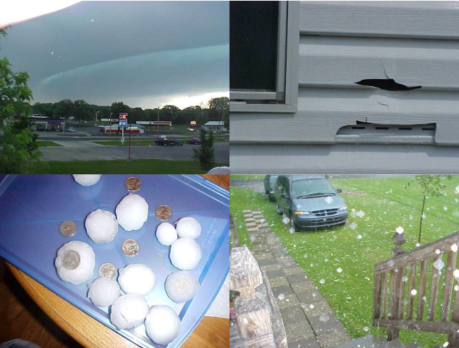
In our area, this event occurred in two rounds. Round #1 was the most destructive with a major hailstorm that moved into Paducah (especially the south side of town), Calvert City, and the northern part of Land Between the Lakes. This event produced over 45-50 million dollars (2024 equivalent) of damage to vehicles and roofs of homes. There were other reports of up to golfball-sized hail and 80MPH winds with this midday round of hailstorms.
Why Was This Event Significant
The Paducah/Calvert City, KY hailstorm was the second most expensive hailstorm in our history, up to baseball-sized hail occurred.
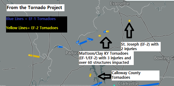
The tornado outbreak portion was pretty significant as well with several EF-2 tornadoes, and some which were quite damaging and caused injuries like the Clay and St. Joseph tornadoes.
This was part of a 7-day sequence both locally and nationwide of hyperactive tornado activity that despite occurring over 20 years ago is still talked about in weather enthusiasts/storm chaser circles to this day.
