
Here is our third and final event for 2007. 2007 is the only year to feature three, top-40 all-time significant weather events. This event, based on total damage to agriculture/gardens, societal impact, and local significance, is the worst and most damaging event in 2007.
The first major factor into why this event ended up producing tens or if not hundreds of millions of dollars of damage began the month before. March 2007 was one of the warmest March’s on record with a string of days in the 70s and 80s areawide and lows well above freezing. This led many people to capitalize on this early warmth which allowed for farmers to grow fruits and for gardeners to prepare their gardens. Trees also fully bloomed and leafed out. Everything was green and was about 2 months ahead of schedule.
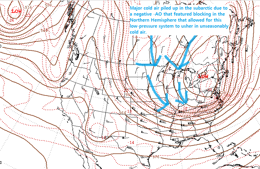
2007 showed us that an early bloom leaves you vulnerable if an unusually cold snap comes in and the stage was set for early April. A powerful cold front along with some widespread hail, damaging winds, and even a brief tornado on the 3rd set the stage for the cooldown. The main low-pressure system meandered across the northeast, pumping cold air that had been locked in place in Canada into our area. This is due to the winds of a low-pressure system moving counter-clockwise and since this low was to our northeast that meant cold air was able to easily usher into our region from the north.
This led to several nights/mornings below freezing. The first two featured lows in the 28-32 range which is damaging but not quite a hard freeze. The night of the 6th through the morning of the 9th (the day after Easter) featured hard freezes. Not only did lows drop below 28F, but stayed below 28F for several hours. Some areas near the Ohio River failed to even rise above 40F during the day, leading to at least 12 hours at a time of subfreezing temperatures, with several of those hours featuring sub-28F temperatures. Some outlying areas dropped as low as 17-20F.
Why Was This Significant
Crop and garden damage exceeded $100 million dollars in 2024 amounts. Apple, peach, and grape crops were wiped out. Dogwood blooms were largely wiped out and significant damage was done to shrubs and even some of our major trees. The lower-than-expected foliage probably made the 2007 drought/heat wave (see #25 on this list) worse as more direct sunlight was able to make it to the ground. Highs in Easter barely reached in the 40s for most places and some areas didn’t even make it 40F putting a significant damper on Easter activities.
Links:
https://www.ncdc.noaa.gov/stormevents/eventdetails.jsp?id=19726
^^ Storm Data Report ^^
