
The most recent event on our Top-40 all-time significant weather list is here at number #15. This was posted within 1-month of this event happening. Damage is still a bit uncertain as the overall Storm Data summary won’t be out till the Fall.
Morning Round
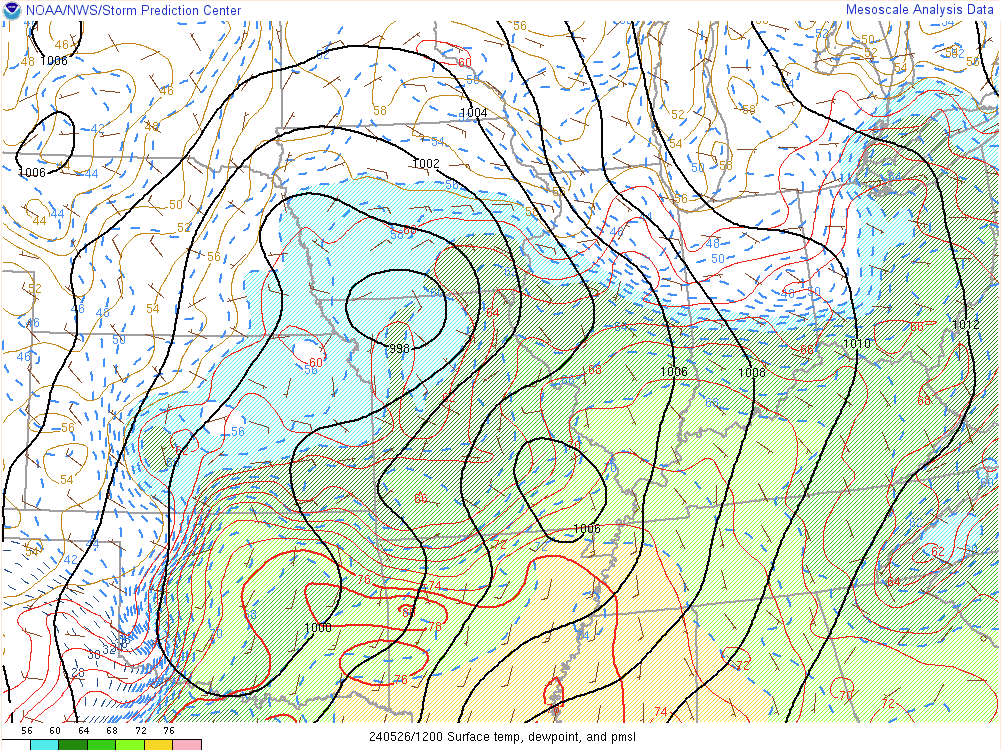
A very humid airmass with dewpoints around 70F was in place as an intense cluster of severe weather moved into the area during the morning hours. Typically, the early to mid-morning sees the least amount of severe weather but if we have the ingredients then you can have severe weather anytime of the day and year.

During this storm cluster, widespread damaging winds occurred across the area. Every single county reported some power outage issues and trees down. The combination of the 60-80MPH (widespread) wind gusts and wet soils due to the wet May, led to widespread trees, trees on powerlines, trees on structures, and such. There was several embedded tornadoes such as an EF-1 in the Dublin/Mayfield area, a EF-1 in Calloway County, two tornadoes in Trigg County including an EF-2 in SE Trigg into Southern Christian County. That latter tornado hit a substation on the Trigg/Christian County line which knocked power out for several areas for up to 5-6 days. Areawide as a result of these storms we had over 20,000 power outages meaning that some people were without power for the second round of storms. Just south of these tornadoes many areas reported 80+ rear-flank downdraft or outflow winds producing additional damage. Such as in Carlisle, Hickman, and Graves Counties and across Christian, Todd, and Logan Counties.
Afternoon Round
There was another round of stronger storms and some flash flooding during the midday hours. The most significant round of severe weather occurred in the early evening hours. Just south of the morning storms in Arkansas and Tennessee was an untapped and extremely humid/moist airmass. When we cleared out after the midday round that untapped and highly unstable airmass advected into our area. The main low-pressure system/cold front moved into that airmass leading to explosive storm development.
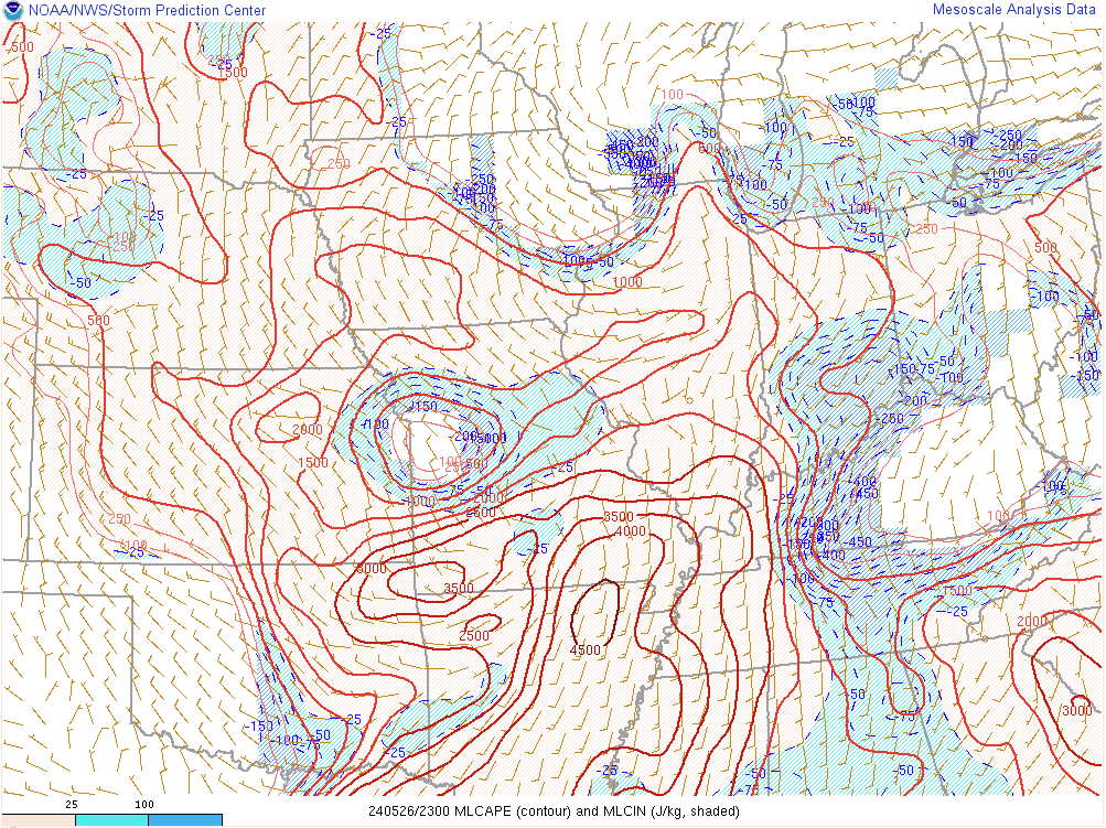
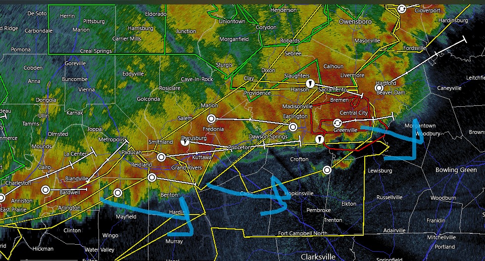
Scattered storms formed and several of these became supercells. There was a supercell cluster in S IL into Union County that became a squall line, but it did produce a EF-0 tornado in Union County. There was a supercell that produced large hail in the Sebree/Robards area into Owensboro, that may have produced a funnel or brief tornado but no evidence was discovered. The main supercell formed just southeast of Paducah and Calvert City. It took a little bit to get organized but the storm rapidly got organized in Lyon County as the storm encountered more lower-level shear.
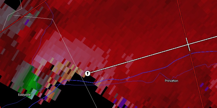
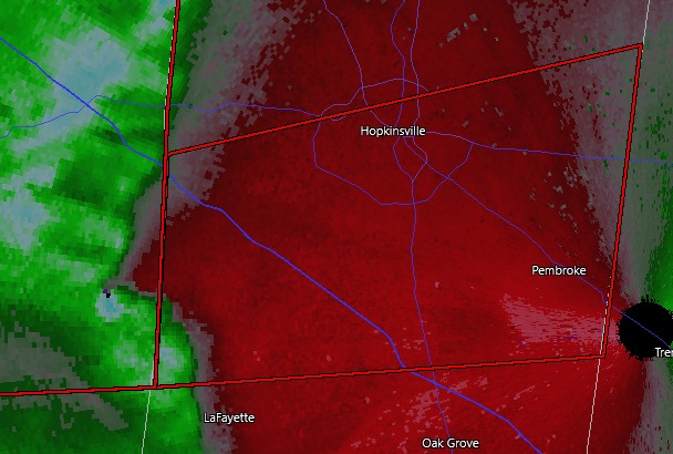
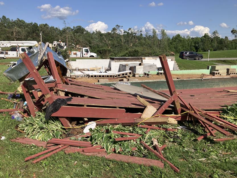
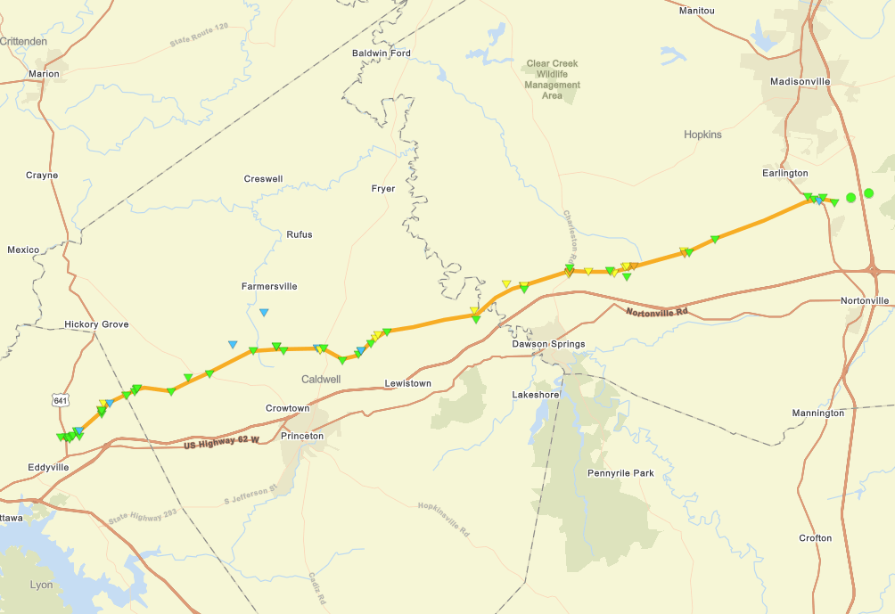
The tornado strengthened to EF-2 intensity as it approached the Lyon/Caldwell County line. The tornado then moved between Princeton and Farmersville (producing tennis-ball-sized hail in Farmersville). The tornado was mostly EF-1 in this part of Caldwell County. The tornado ramped up to EF-2 strength as it moved into Hopkins County, going through the northern outskirts of Dawson Springs and impacting the southern end of the Charleston area. At this time the tornado was at its maximum strength a high-end EF-3 tornado. Sadly several injuries and 1 fatality occurred as this tornado moved from Charleston to Illsley to the Barnlsey Loop area (the latter two areas were also hit by a major tornado 2.5 years ago). The tornado passed between Earlington and Morton’s Gap before lifting. This tornado likely destroyed or heavily damaged tens of homes and caused at least several millions of dollars of damage.

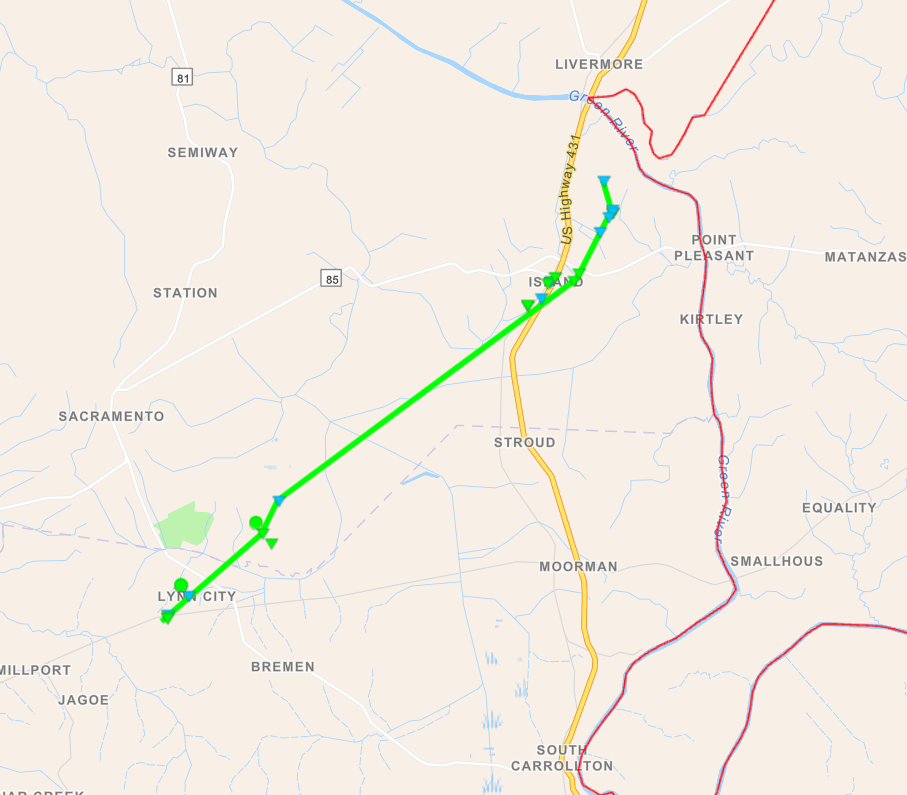
This storm then merged with the incoming squall line to the south. This initial storm still produced a long-tracked EF-1 tornado in Muhlenberg, Butler, and Warren Counties. This tornado damaged several structures in the Beech Creek/Beechmont area of Muhlenberg County before impacting the Huntsville area of SW Butler County. This storm moved into Warren County and ended in the Girkin community north of Bowling Green. This tornado also likely did at least 1-2 million dollars of damage and widespread power outages.
Why Was This Event Significant
- There have only been 5 deadly tornado outbreaks to occur in our area in the last 30 years. We discussed one of them (2/24/2018) already and we will discuss the other 3 in later posts.
- This event unlike several of the previous but still very significant events had impacts across all 29 counties of our area. Whether it was by tornado or damaging winds. Over 75,000 people in our area were without power with full restoration taking up to 1 week. Outages lasted longer than the March 2023 wind event in some areas and featured some of the worst outages since the 2009 Ice Storm for some areas.
LINKS
https://www.weather.gov/pah/May26_2024Severe
^^ NWS Paducah link ^^
