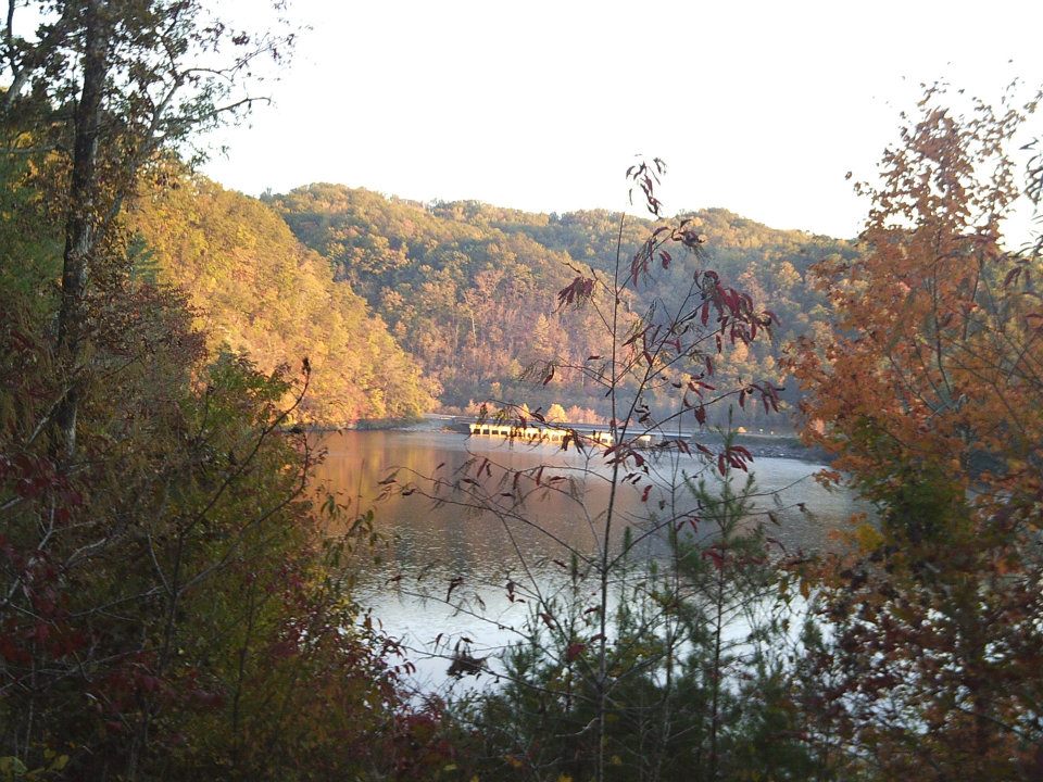
One should never underestimate the power of the river. Entire landscapes are created by rivers, fast moving streams of water that contain a lot of power. In the southeastern corner of Tennessee, is an example of a river that contains so much power that it actually generates energy and has captured the fascination of mankind. This is the Ocoee River in Polk County Tennessee and here is its highlighted community.

Location:
Latitude and longitude is determine by the central location of Parksville/Ocoee Lake.
Latitude: 35.1 Degrees North
Longitude: 84.61 Degrees West
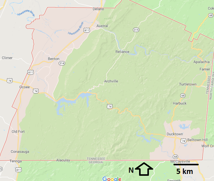

Ocoee and Ducktown are both in Polk County Tennessee which is the farthest southeastern county in the state of Tennessee. The Ocoee area and points west are part of the Valley and Ridge Province which features tall ridges which are made of more resistant rock such as sandstone and valleys which are made of limestone that is more prone to weathering, especially chemical weathering. The eastern half of Polk County including Ducktown is part of the Blue Ridge Mountains which features a mix of sedimentary and metamorphic rock types. Significant sections of Polk County are part of the Cherokee National Forest.
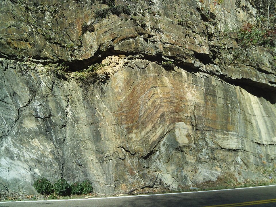
Across the area the rock has been intensely folded and faulted due to the uplift of the Appalachian Mountains (around 300 million years ago) which occurred after the rocks were deposited. The rocks in the Ocoee area (the town) and points west are about 450-550 Million Years old and the rocks in the Blue Ridge Mountains tend to be over 550 million years old. This is about 250 million years before the Dinosaurs began to appear.
Ducktown and Ocoee both contain Humid Subtropical Climates with hot and very humid summers and warm spring and fall seasons. It should be noted that areas like Ducktown the higher elevations nearby do receive more snow in the winter versus lower elevations in Southeastern TN due to their higher elevation and Orographic Lifting where updrafts are formed as updrafts are forced upward along the windward side of the mountains.
History:
Before European Settlement this land was inhabited by Native Americans especially the Cherokee Tribe. This part of Tennessee along with adjacent portions of Georgia and North Carolina were part of the old Cherokee Nation (starting in the 1790s) which represented the first time that the Cherokee people had a nationalized form of government. Unfortunately this did not last as the Indian Removal of Act in 1830 forced the Cherokee people to leave the area and head to Oklahoma via the Trail of Tears that I discussed in the Woodbury and Hopkinsville articles.
https://nooga.com/165052/historic-ducktown-basin-a-landscape-transformed/
^^ This link provides additional information for the section discussed below ^^
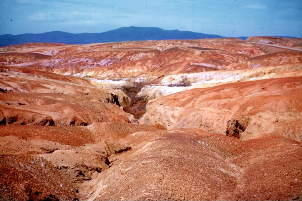
The community was slowly developed but in 1843 an important discovery would change that. In 1843, Copper was discovered in 1843 in the Ducktown area and the landscape was transformed from quiet forest to a full-blown mining operation. This was known as the Ducktown Basin and was one of the largest metal mining sites in the entire Southeastern USA. This site supplied much of its Copper supply to the Confederate Army during the Civil War. The mining, manufacturing, and employment opportunities were not the only changes occurring in the area. The mining and especially a process known as Copper-Smelting was transforming a lush forest to a barren Mars like landscape. This version of Copper Smelting required wood so extensive logging was required that cleared the forests in the area. This process released Sulfur into the atmosphere which produced acid rain that dealt significant damage to the landscape. Plants and their root systems help stabilize the soil so without these trees, which were destroyed by logging and acid rain, extensive erosion occurred and top soil was removed and sent down the waterways. The mining has ended and has been over for the past several decades and currently the land is recovering. This provides a reminder of how easy it is to disrupt the national ecosystem and the consequences that can result when that happens.
Ready, Set, Rapids:
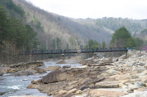
The Ocoee River was owned by the Eastern Tennessee Power Company and during the 1910s two locks were constructed on the Ocoee River along with a wooden floom line to divert the river to feed hydro electric turbines and produce hydropower. In 1939, TVA the Tennessee Valley Authority purchased this river and the river was allowed to flow across the river bed in 1976. Instantly, with the power of river along with the boulders in the river help create rapids and strong currents suitable for whitewater rafting. In 1996, the Ocoee River area appeared on the international stage due to the Summer Olympics of 1996. The Ocoee River was the only watercourse used in the slalom competition and was used in activities like kayaking. The Ocoee Whitewater Center near Ducktown was the main venue for these events.
Conclusion:
Polk County and the surrounding area is quite scenic. This is a great vacation place to go if you want to enjoy the Southern Appalachian scenery but without the crowds of a place like Asheville or Gatlinburg. Not only do you have the whitewater rafting and amazing river scenery but you also have the forests of Cherokee National Forest which contain abundant hiking trails, camping, and overall enjoyment of nature. This area has quite a bit of history from Native Americans, copper mining, and its stage as part of the summer Olympics of 1996 and I would recommend any nature lover to at least spend a weekend in this area. I hope you all enjoyed learning about the Ocoee River area and next weekend we will go overseas for a highlighted community that you don’t want to miss.